Category:Road pre-costruction
Scope:DEM, DTM, DSM, Contour lines
Equipment:Phoenix Scout-16, DJI Matrice M600 Pro, DJI Mavic Air
Localization:Soverato, Calabria, Italy
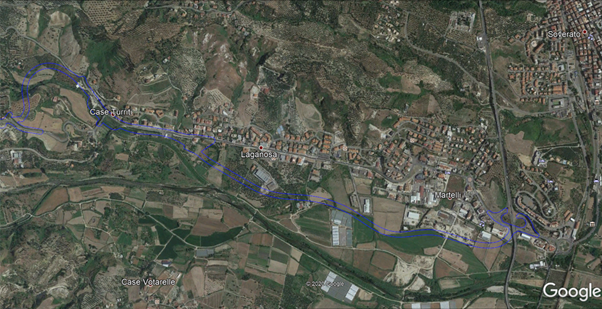
In August 2020 AMI Systems participated successfully, in cooperation with Global Service S.r.l. a survey company from Rome, in mapping more than 200acres of area between Soverato and Gagliato.
Scouting
A pre-flight is conducted with DJI Mavic 2 to ensure the mission safety towards possible obstacles
Acquisition flight
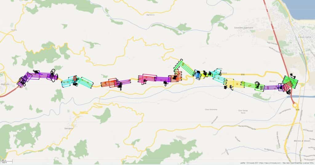
This is a typical topography scan for which we utilize the Phoenix’s Scout 16 LiDAR mapping system integrated on DJI M600 Pro. Due to the nature of the area involved we execute the scan in a corridor mode with multiples laser returns.
The site aimed to be the location of new road link between the two cities mentioned above.
Supported by ANAS the project consisted into building a road passing next to the currently
inhabited towns and re-adapting, where possible, the existing link into a less curvy more fast-paced highway
A standard GNSS point to point collection technique would result inadequate considering the vegetation and time involved into it, not mentioning the result: around 1 point every 30m.
Instead we delivered a precise classified point-cloud where is possible to exclude vegetation, estimate the terrain angles and elevation, with more than 300 points per square meter and all under a week !
Why an UAV LiDAR scan
– The terrain: rough, densely vegetated and inaccessible in some parts
– The creation of an accurate DTM and DSM
– The possibility to work in any light condition (unlike Photogrammetry)
– The possibility to filter and exclude vegetation
– The time required to complete the survey and deliver a geo-referenced product: greatly reduced
Pre-flight
The whole corridor has been divided in smaller more accessible segments and polygon. More than a pre-flight is conducted in every section of the divided corridor in order to establish the correct safe altitude before the final acquisition flight with the M600 Pro. Smaller drones such as a Mavic 1 and a Phantom 4 Pro V2 come to our rescue in estimating risks and in pre-surveying the area.
Acquisition flight
Consequently the acquisition multiples flights are then carried smoothly one after the other with no disruptions. A collage of an area composed by different point-clouds has been generated. At this moment remains only to merge the different acquired sections together and draw the final conclusion before handing the final product to the customer for further evaluations.
Data analysis and Results
DSM (Digital Surface Model)
Building location and heights:
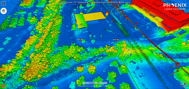
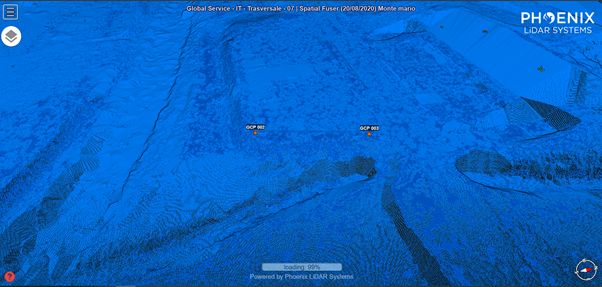
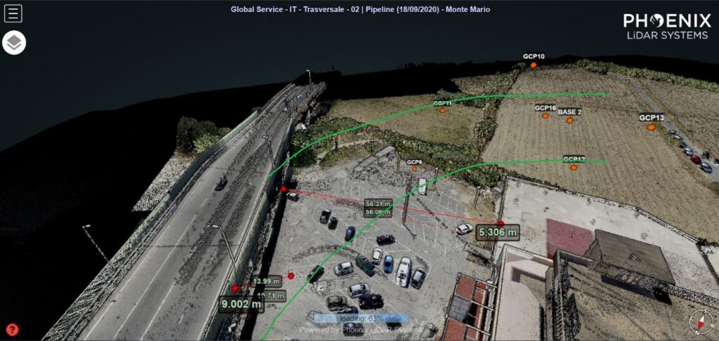
On the following example is possible to observe how a DSM of the current crossroad infrastructure facilitate the project case study.
The goal here is to evaluate the distance between the existing building the actual road. A Branch is needed to be constructed starting from the main intersection roundabout, other data available such as terrain altitude and conformation.
DTM (Digital Terrain Model)
Rock face morphology:
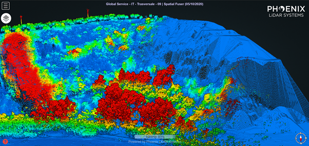
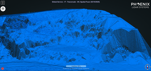
In order to better discuss the terrain conformation let’s take as an example of another area where a ramp with a 10% angle slope needs to be build.
Here is clearly visible a rocky wall in all of it’s characteristics: a manual survey wouldn’t be viable in this case (very difficult access). Therefore with a quick UAV flight we were able to recreate a 3D profile of the hill elevation in order to draft eventual pillars location or more of the projects related aspects.
Another 2 examples that highlight how land morphology is clearly visible with LiDAR: river banks and hill peak “flat” area estimation.
River banks:
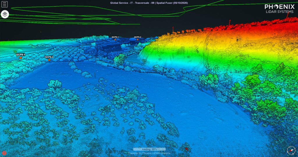
With a normal survey or photogrammetry wouldn’t be absolutely possible to see the river profile underneath all the vegetation that normally grows next to water sources. This a clear example how a DTM, obtained with a dual return LiDAR sensor, can solve engineering design problems. Is also a very useful tool in case of bank monitoring (cost erosion and river flood prevention, we have currently costumers operating in Netherlands with this exact system).
Hill peak “flat” area:
Is not easy to plan a road across a landscape that allows no project error margin. Calabria is a very good example how structural engineering has to deal with minimal spaces and a very adverse territorial conformation for planners.
LiDAR comes to our rescue once again with a detailed 3D model. Here is possible to accurately plan any road construction by calculating the amount of soil in m³ that needs to be removed or filled in order to obtain an adequate surface to lay down a road with no complications or over budget expenses in terms of unnecessary heavy machinery required to complete the project.
